Public Life Street Assessments give valuable insight and evidence into how people currently use city streets and outdoor spaces that can help inform design decisions or allocation of resources. Whilst working at HERE+NOW, I acted as Lead Consultant for client City of Edinburgh Council to project manage and deliver 9 of these reports, combining user research, data and design of these town centre street environments across Edinburgh. The full reports are available on the Planning Edinburgh website.
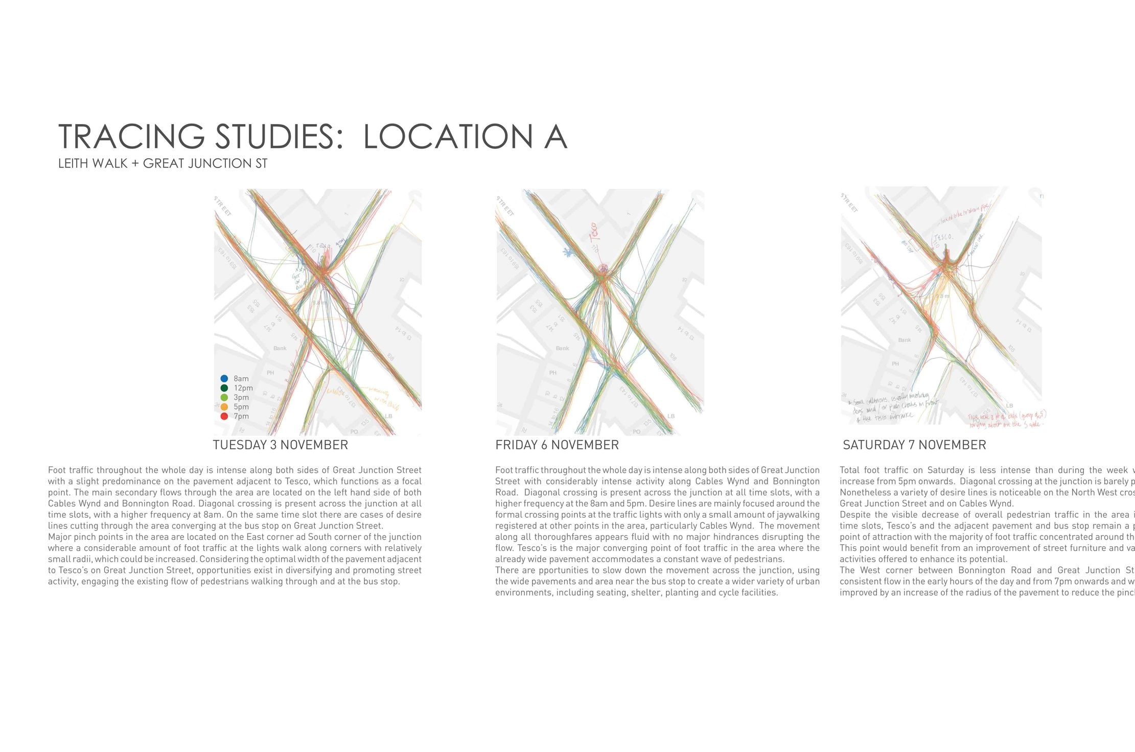
Methodologies used included on-the-ground user interviews and direct observation of pedestrians and cyclists, feeding in to evidence-based decision-making for street design improvements. The insight provided is based on rigorous data and analysis of each street environment’s movement and place functions and current user experience.
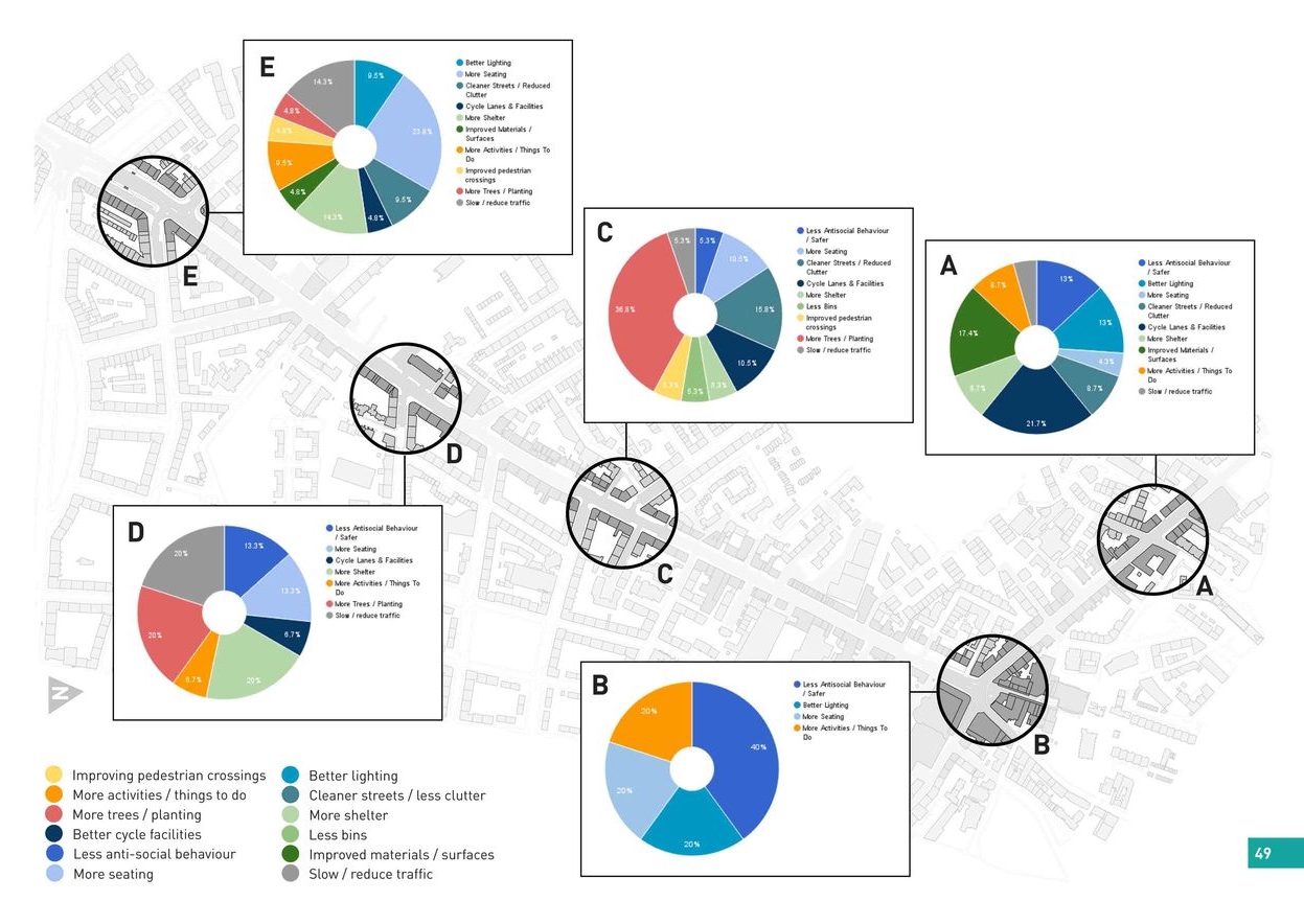
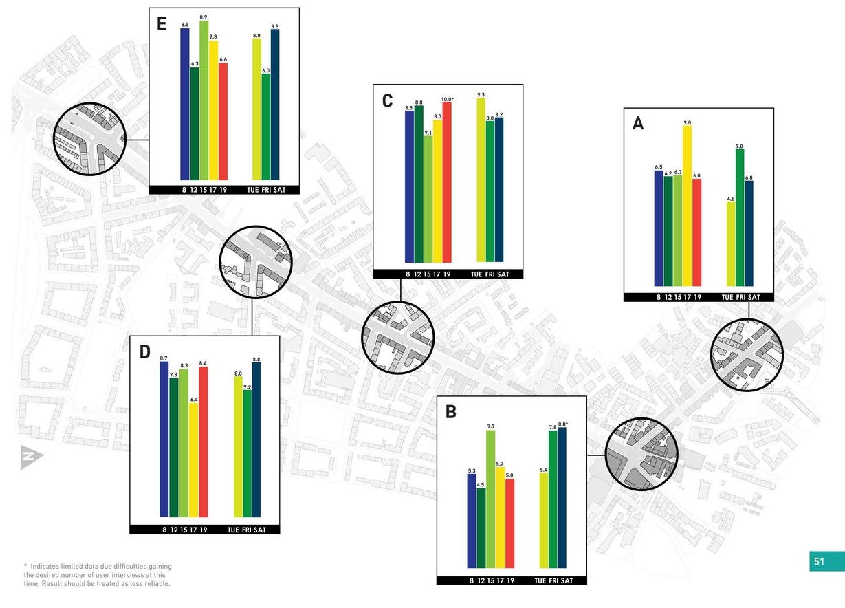
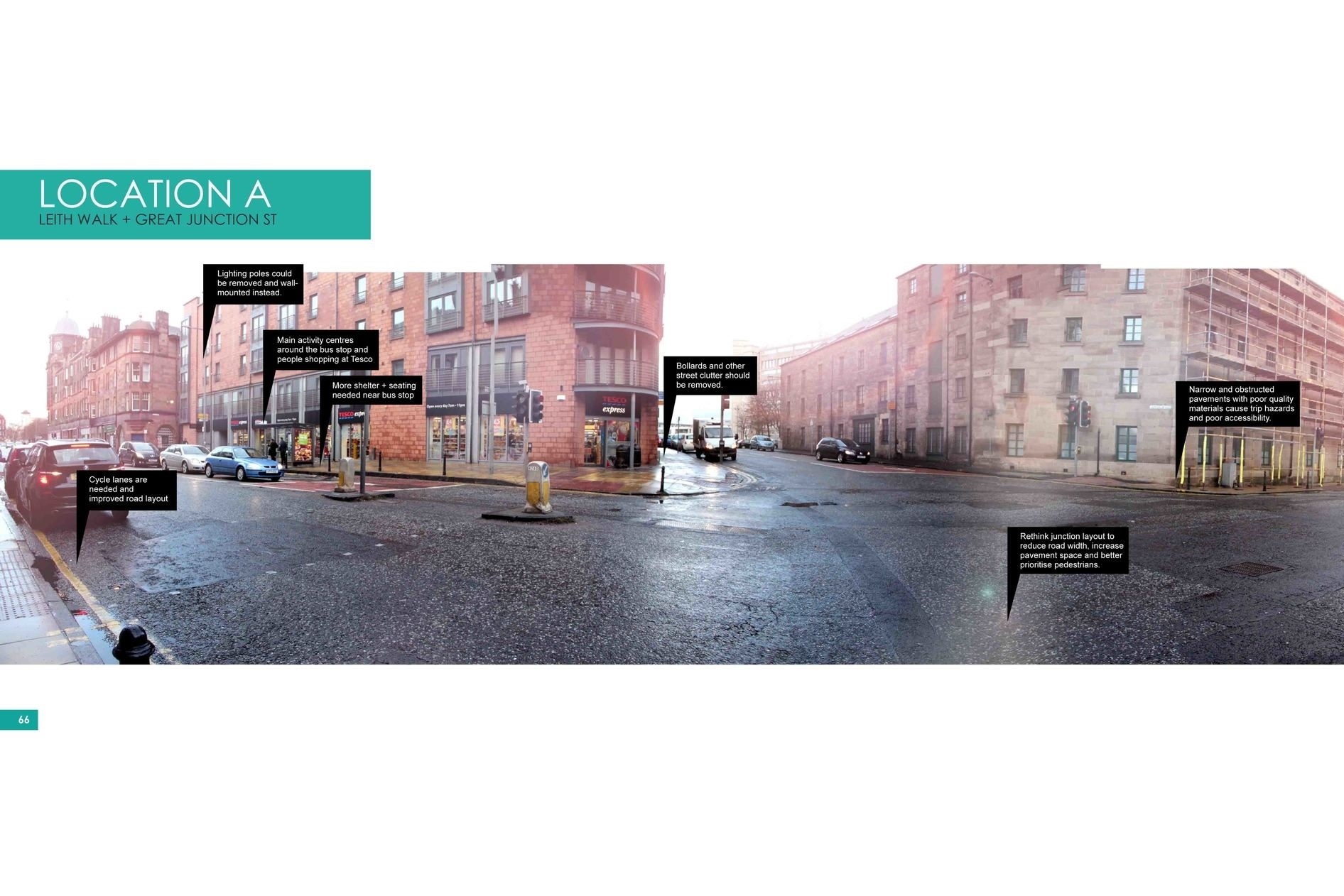
Whilst at HERE+NOW, I conducted a series of Public Life Street Assessments of eight important local town centres across Edinburgh - Portobello, Stockbridge, Nicolson St and Clerk St, Bruntsfield/Morningside, Leith Walk/Great Junction St, Gorgie/Dalry, Tollcross and Corstorphine, as well as a ninth study of George St in central Edinburgh. These street assessments give insight into how the built environment of each town centre is currently functioning in terms of public life, with a particular focus on pedestrian and cyclist user experience. My role involved designing this research, leading the team of researchers, analysing data and summarising this and any subsequent design recommendations in a comprehensive report.
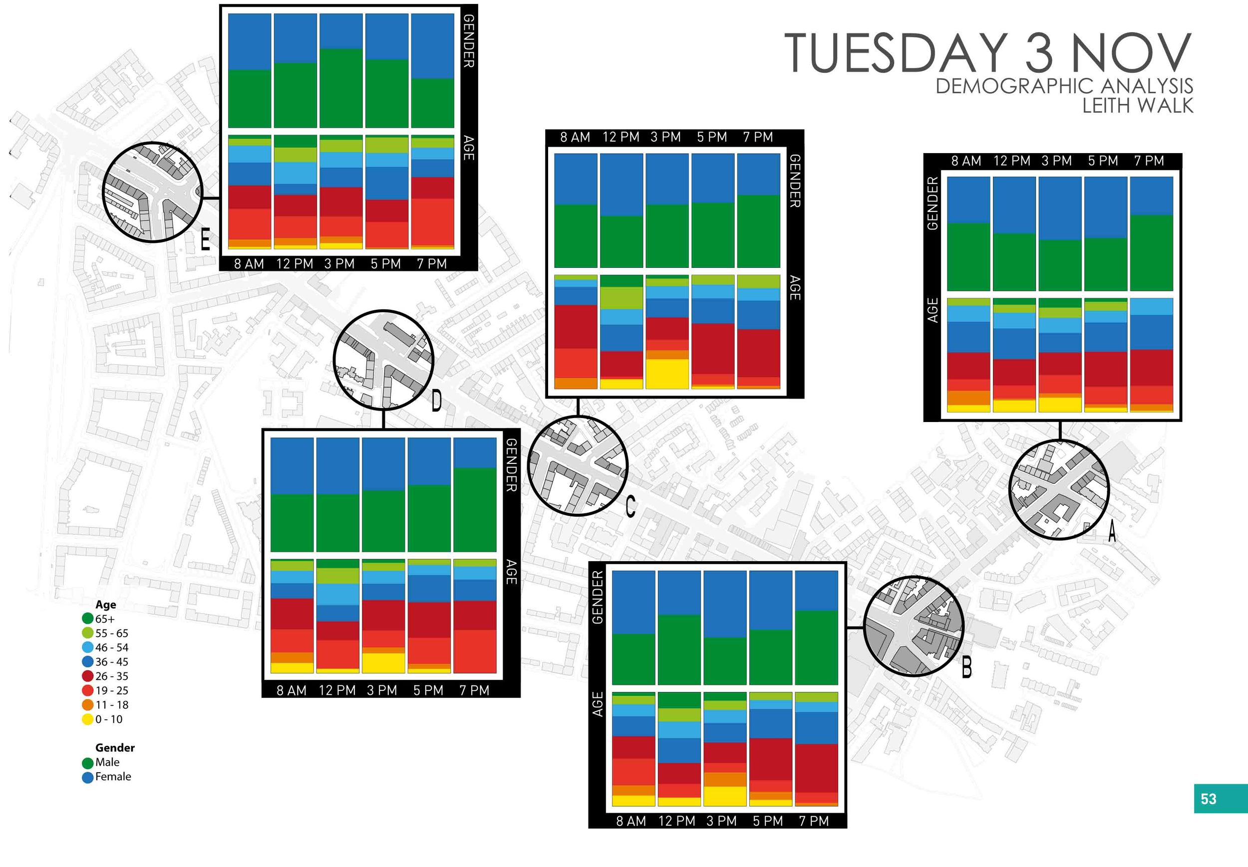
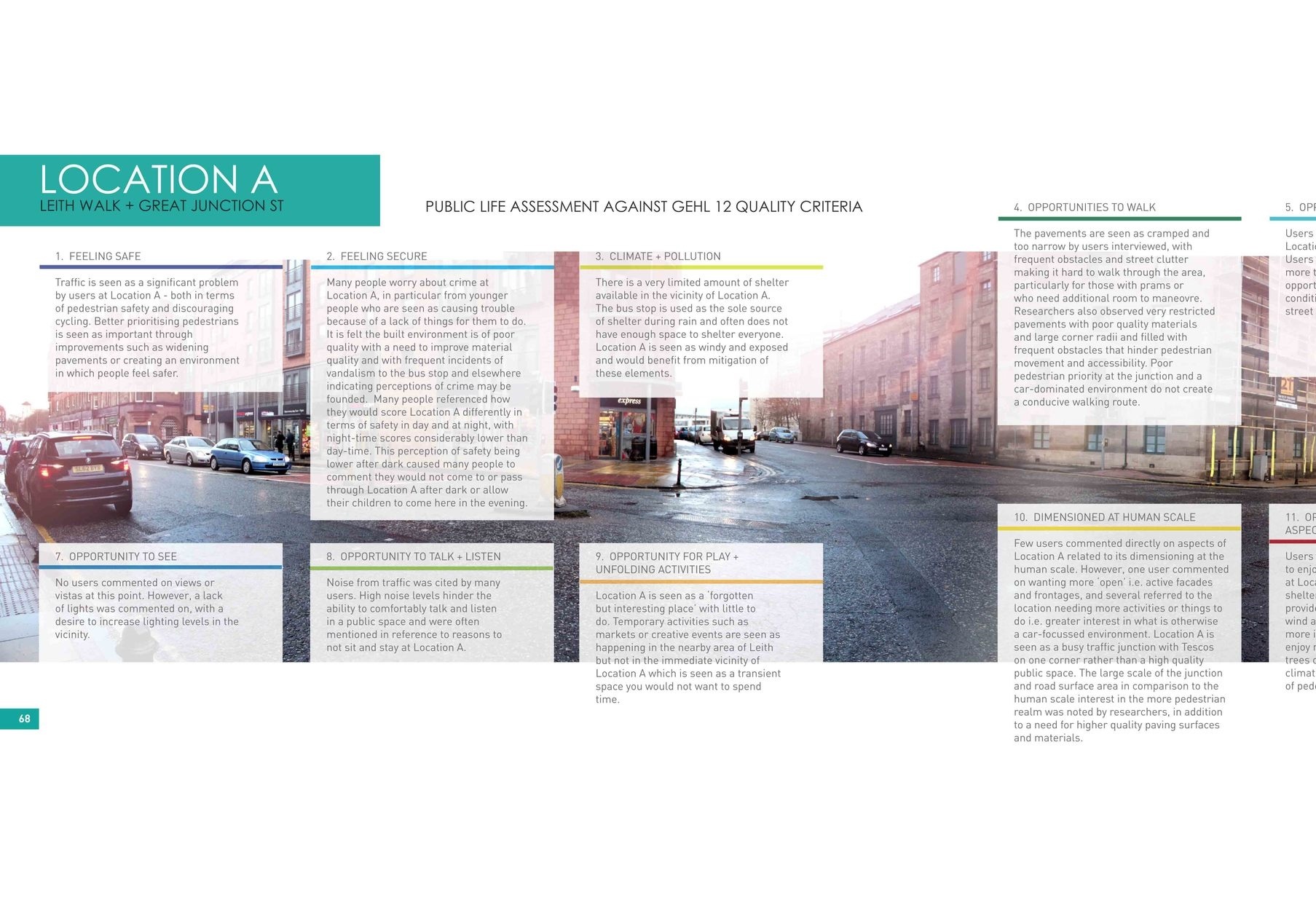
To carry out Public Life Street Assessments, direct observation methodologies are used in combination with qualitative semi-structured user interviews, and the expertise and observations of the research team of landscape architects and urban designers. Together this mixed method approach enables a large amount of useful data and analysis regarding the town centres in terms of their existing public life, user experience, and movement and place functions.
The suite of research tools and techniques used represent current best practice based on methodologies advocated by Gehl Architects, and were complemented by our own expertise and development of a series of analysis tools. Research is carried out in a standardised consistent manner by a team of researchers across multiple locations, at different times of day and on different days of the week to ensure the maximum diversity of usage patterns is captured.
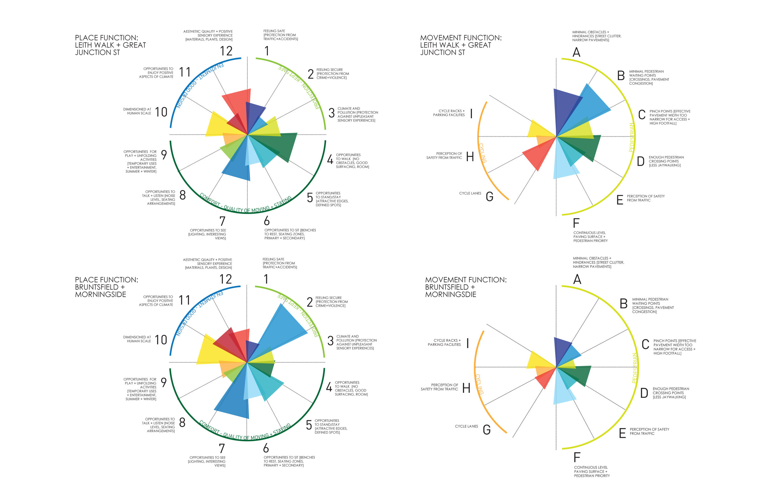
Collection of this data, its analysis and interpretation in terms of both the whole town centre and selected site-specific locations, gives incredible insight into the ways the street or town centre currently functions for users in terms of movement and as a place. This analysis is used in combination with the 12 Design Principles for Healthy Public Spaces I developed during my Masters. These principles were based on a synthesis of the most pertinent academic literature to date. The output is a report detailing this evidence and the way it can be used to target improvements in these places to create most impact, including a holistic series of design recommendations aimed at creating a place with enhanced conditions for walking and cycling, as well as opportunities for public life.